Cycling route from Málaga to Axarquía highlands
2-day bikepacking route from Málaga into the mountain landscapes of Axarquía and Málaga Province
147km 2298hm
This two-day cycling route connects the eastern coastline of Málaga with the inland highlands, passing through mountain landscapes and several traditional white villages along the way. On the return, the route heads back toward the city through the pine forests of the Montes de Málaga Natural Park. Along the route, travellers experience several characteristic landscapes of Axarquía, ranging from subtropical farmland near the coast to an elevated plateau shaped by agriculture and open mountain surroundings.
Any of the mountain villages along this section can work well for an overnight stay. We consider Alfarnate and Riogordo to be the most interesting options, as both are located roughly halfway along the route.
Alfarnate lies slightly earlier on the route and at a higher elevation in the mountains. From here, it is possible to include an optional additional loop toward scenic mountain areas such as Puerto de los Alazores.
Riogordo is another good option for the second day. It is slightly larger and more lively, and offers a calm pueblo blanco setting with several accommodation options and a relaxed village atmosphere.
The main route is suitable for different types of bikes available through bike rental in Malaga, depending on your travel style, luggage setup and preferred riding rhythm. If you choose to include the Alfarnate Loop, a mountain bike or gravel bike is recommended, as parts of the route are unpaved.
Route description
The route begins along the shoreline east of Málaga, following quiet seaside roads, fishing neighbourhoods, and open Mediterranean views. After Almayate, the road turns inland and rises gradually into the Axarquía region. Here, the landscape becomes subtropical, with mangos, avocados, citrus groves, and small family farms forming a varied green mosaic.

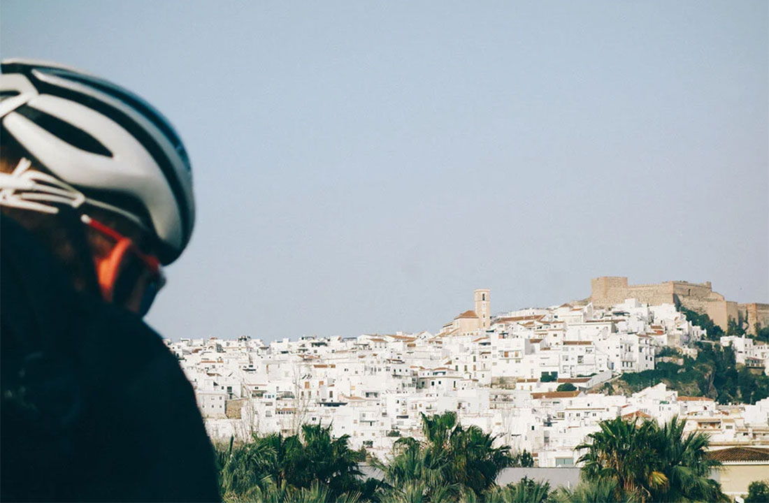
The route continues through Vélez-Málaga, the historic capital of Axarquía – a natural transition point before the higher inland areas. From here, the surroundings shift toward more mountainous terrain, with long views across valleys dotted with white villages. The climb to Ventas de Zafarraya leads into one of the most characteristic natural passages of Andalusia – a corridor between two rocky walls that has long been known among local riders and travellers. This section stands out as one of the most visually striking parts of the route.

Ventas de Zafarraya itself is a small, mainly agricultural town. Depending on the day, it may be difficult to find open cafés, although supermarkets and fresh water sources are always available. After entering the Zafarraya Plateau, the landscape opens again, with broad fields and a wide high-valley setting.
Past the plateau, and after the point known as Venta de Leche, the route turns back toward the coast and begins its descent, passing through Alfarnate and Alfarnatejo – mountain villages with a long historical background. Near Alfarnatejo, the road passes close to the rock formations of El Tajo de Gómer and El Fraile. These cliffs frame the surrounding valley and are characteristic of this mountain area of Málaga province. Along the way, the route also passes Venta de Alfarnate, a 17th-century inn once used by merchants, travellers, and the bandoleros associated with this region.
If you decide to stay overnight in Alfarnate, there’s the option to add a scenic cycling loop offering beautiful landscapes and a rewarding stop at Fuente de los Cien Caños – a natural monument of Andalusia near Villanueva del Trabuco, where water from the Sierra de San Jorge emerges to form the main source of the Guadalhorce River.
A further descent leads into Riogordo, a calm pueblo blanco surrounded by olive groves. With its small cafés, guesthouses, and a relaxed village atmosphere, it works well as a quiet place to finish the day.
After Riogordo, the route passes through Colmenar – a typical inland town known in the region for its honey and olive oil. From here, the road enters the Montes de Málaga, a protected natural area with pine forests, winding roads, and open viewpoints across the surrounding valleys. The descent back toward Málaga is long and gradual, with open views of the city and coastline appearing as you approach the lower slopes. The final section leads directly back into Málaga, completing a two-day loop that combines coastal riding, agricultural landscapes, elevated inland terrain, and forested mountain roads.
Interesting places along the route
Cuevas del Tesoro (optional coastal detour)
A unique marine cave system in Rincón de la Victoria – one of the few sea-formed caves in Europe. An atmospheric cultural stop before turning inland.
Embalse de la Viñuela
A scenically located reservoir set within the landscapes of Axarquía, supplying water to the surrounding farmland.
Boquete de Zafarraya
A dramatic natural mountain gateway between Málaga and Granada. Known for its impressive rock walls and expansive views across the plateau.
Mirador del Boquete
A viewpoint overlooking Axarquía’s valleys – perfect for a short pause.
Venta de Leche
A location well known among local riders as Venta de Leche (translated as “Milk Sale”), marking the point just before a small rural junction where the route turns back toward the coast.
Puerto de los Alazores
A scenic mountain pass located between Málaga and Granada provinces, offering long views across rolling hills. Historically, this pass was one of the most important natural connections between the two provinces and formed part of the historic main road – Camino Real – linking Granada with Málaga. If you would like to explore this beautiful area further, check our route extension, suitable for gravel or MTB bikes.
MTB / Gravel Loop from Alfarnate
An optional cycling loop through scenic mountainous terrain, starting directly from Alfarnate. The route passes through quiet rural areas and includes Fuente de las Cien Cañas, a natural water source along the way.
This loop works well as an additional ride for bikepackers or travellers who choose to stay overnight in Alfarnate and want to explore more of the surrounding mountain landscape. Best suited to gravel bikes or MTB, as some sections of the route are unpaved.
El Tajo de Gomer / El Fraile
Striking rock formations near Alfarnate that create a natural “mountain amphitheatre” around the valley.
Venta de Alfarnate
A 17th-century inn on the historic Málaga–Granada trading route, associated with travellers, merchants and local bandoleros.
Miradores de la Axarquía
A series of natural viewpoints between Riogordo and Colmenar, offering soft morning light and long valley views.
Colmenar
A traditional Andalusian village known as the gateway to Montes de Málaga – also noted for its local honey and small-batch wines.
Lagar de Torrijos
An 18th-century wine-making house in Montes de Málaga Natural Park, preserved as an open-air ethnographic museum.
Mirador del Cochino
One of the most iconic viewpoints in Montes de Málaga, offering forested panoramas and occasional glimpses toward the sea.

This route was previously published as a road bike route on our old Escapada website. We updated the content to reflect our new Travel & Adventure concept while keeping the same region and key highlights.
Images and text by Escapada Cycling