Casabermeja
73km 1643hm
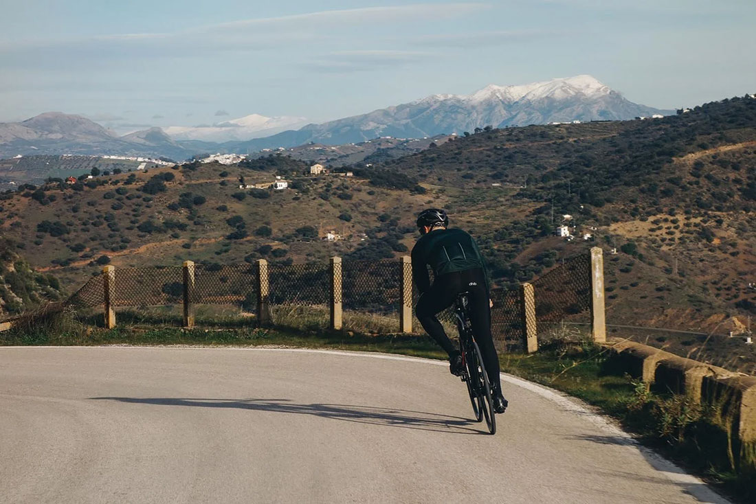
This cycling route leads to the mountain village of Casabermeja, set in the hills north of Málaga. Along the way, beautiful views unfold across the surrounding landscapes, with climbs that gently suggest taking your time and looking around a little more often than usual :)

This cycling route to Casabermeja starts with an important recommendation on our part. The route, at a glance, does not have any complication in terms of steep inclines or excessive total elevation. However, that facility when climbing naturally pushes the cyclist to ride even faster than usual and in his quest for reaching Casabermeja, end up bonking half way through. Thus, we recommend carrying 2 water bottles and enough snacks, as well as keeping attention to hydration and supplementation during the first half of the course.
To start with, follow directions in town towards the Jardín Botánico de la Concepción (Botanical Garden), on the northern side of the city. Shortly after you will be on the right direction to connect with the MA-3101, that will take you straight to Casabermeja.
At the beginning of the road, there is an old dam – Embalse del Agujero – from 1908, specifically built to avoid the flash flooding affecting Malaga after intensive deforestation in the early twentieth century. It works well as a short stop and the first viewpoint over the city, with higher and more open views appearing gradually as the route continues uphill.
The first, longest uphill has almost 30 kilometers and a few moments to catch your breath. After about an hour, the first prize will be a panorama of the mountains in the east, Sierra de Mijas and Sierra de las Nieves. They will help you forget about the stuggles of climbing and immediately reach the first, short downhill to Casabermeja.
Casabermeja, known as the "gateway to Malaga" is the first town on the plateau, next to Colmenar. In both we can find small, local bars, perfect for coffeebreak and filling waterbottles.

Casabermeja has a long history linked to its position between the coast and the inland plateau. It is close enough to Málaga to be reached comfortably in a day, yet it already feels like rural Andalusia. Thanks to its location, Casabermeja is often the first inland town visited by travellers who want to explore the interior landscapes of the region without moving far from the coast.
The name Casabermeja comes from Arabic, meaning “Red Castle” or “Red House”. It refers to an early structure built with local reddish earth, a color that remains visible today in the town’s coat of arms and reflects its historical connection to the land and the Arab period in the region.
The village keeps a compact historic centre with white houses and narrow streets. One of its most distinctive landmarks is the 19th-century cemetery, built like a small town with streets and façades, and considered unique in Andalusia.
Colmenar – another well-known mountain village – has a strong traditional character linked to its inland location. The area is closely connected to olive oil production, which has shaped both the surrounding landscape and the local economy. Beekeeping is also important here, and local honey is a common product found in small shops and bars.
If you feel tired or short on water, it is best to seek refuge in a bar in Casabermeja, as the way from Casabermeja to Colmenar lasts for about 10 kilometers.

Later on, the route returns to the Montes de Málaga. The Montes de Málaga form a natural area of hills and forest directly north of the city. The landscape is dominated by pine forests, dry riverbeds, and long ridgelines, shaped by forestry and traditional rural use. Along the way, Fuente de la Reina appears as a traditional roadside spring, historically used by travellers and locals, and still known among local riders as a common reference point on routes through the Montes de Málaga. Open sections of the road offer wide panoramas back towards Málaga and the coastline. From here, a second, shorter climb leads towards Puerto del León, a well-known mountain pass with open views to the west. The route then continues on a long descent that gradually brings you back into the centre of Málaga.

This route was previously published as a road bike route on our old Escapada website. We updated the content to reflect our new Travel & Adventure concept while keeping the same region and key highlights.
Images and text by Escapada Cycling